Scientists from the University of South Florida (USF) are using 3D technology to conduct research that could potentially rewrite the history of Greek Sicily.
Since last year, the team has used advanced digital technologies to study the ancient city of Heloros, which dates to the eighth century BCE. Visualizations from the study will soon be available to the public via virtual immersive reality.
The project is a multi-year collaboration between the university’s Institute for Digital Exploration (IDEx) and the Archaeological and Environmental Park of Syracuse, Eloro, Villa del Tellaro and Akrai.
USF Humanities Professor and IDEx Director Davide Tanasi, an internationally recognized archaeologist, designed the fieldwork. Tanasi is known for discovering the chemical signatures of the oldest wine and olive oil in European and Mediterranean history and conducting the genomic study on trench fever in Roman times.
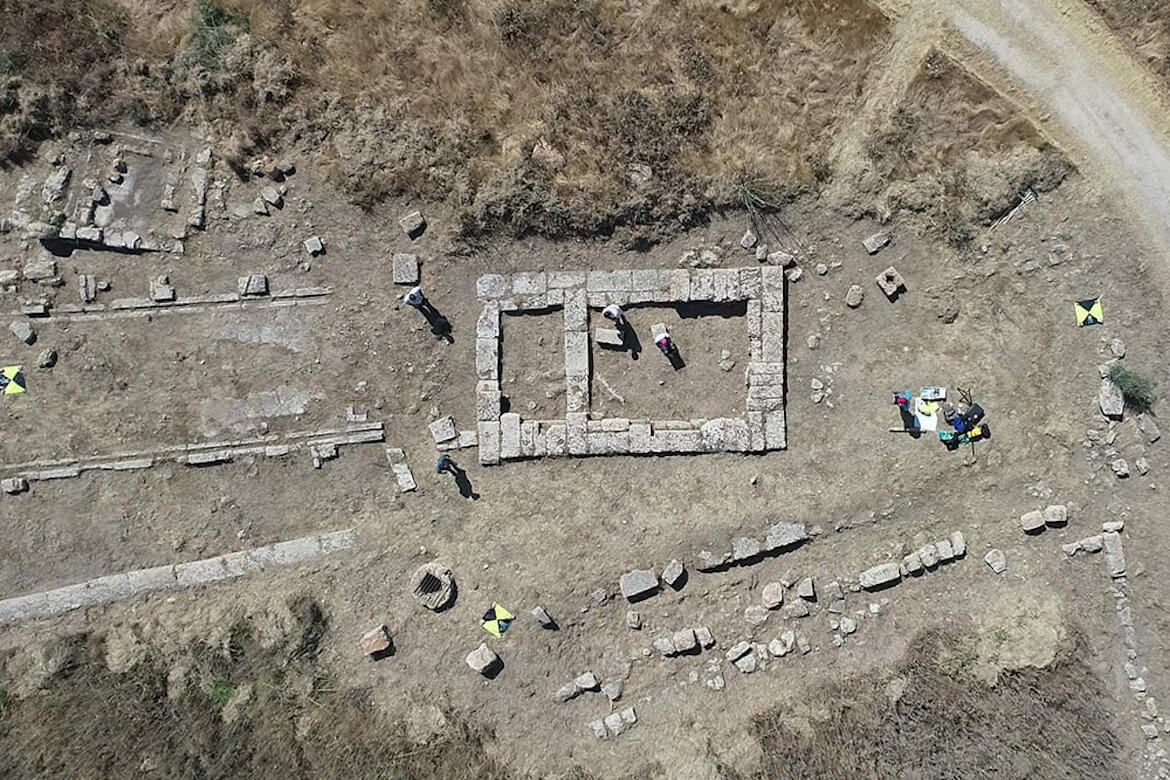
This summer, Tanasi led a group of five USF graduate students from the history department and a team of archaeologists, computer scientists and geophysicists to conduct a preliminary integrated analysis. The team has since identified previously unknown parts of Heloros’ urban layout, which now shows new houses, roads and public buildings.
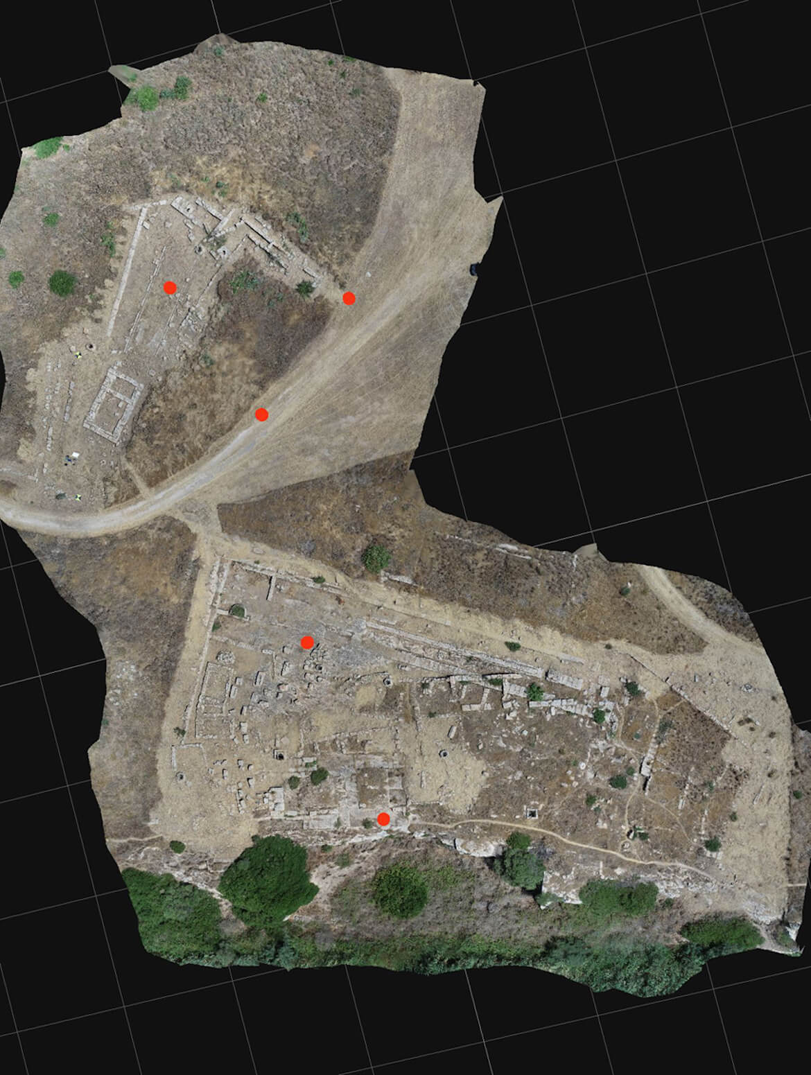
The team has worked across time zones from Sicily to Tampa, Florida, as researchers perform the 3D digitization at the archaeological site and share data with their colleagues at the IDEx lab.
“The home team preprocessed the raw 3D data and sent them back to us with comments and directions to continue,” Tanasi said in a university press release. “It’s a sort of ‘hybrid fieldwork’, where we live-streamed from the site and held many Teams meetings.”
The team working on-site used high-tech 3D digitization techniques, spatial analysis and geophysical prospections to map out sections of the site uncovered a long time ago which were never fully studied. The rest of the city still lies underground.
“The high-resolution 3D models generated will be used to monitor the conditions of the site over time,” Tanasi said. “We’ll also be able to test research hypotheses in a virtual environment and promote this important archaeological site to the general public online.”
The high-resolution data being gathered and which will eventually be shared by the IDEx team will aid future archaeological excavations.
The team will spend the fall processing data collected from the laser scanning and ground penetrating radar and release 3D models and the geographic information system visualizations online. These virtual reconstructions will also incorporate data acquired through traditional topographic methods to improve previous archaeological site maps.
Heloros encompasses an estimated area of 20 acres of which scientists have uncovered approximately five percent.
Researchers plan to complete the digital scanning and subsurface mapping of the entire city in 2022 and begin traditional archaeological excavations in 2024.
For more information about the project, visit the university’s website.