
It cools the islands, churns the sea, fills sails and occasionally keeps ferries in port. The Meltemi is as much a part of an Aegean summer as whitewashed villages and brilliant blue water.
Anyone who has spent enough time in the Cyclades during July or August knows the moment.
The sky can be perfectly blue. The sun can be blazing. There may not be a cloud anywhere over the Aegean. And yet the sea is covered with whitecaps, beach umbrellas are straining against their anchors and the afternoon ferry is pitching its way toward the harbor.
That is the Meltemi.
Greece received a particularly vivid reminder of its power in mid-August 2026. On August 14, the National Observatory of Athens recorded an intensified Meltemi across the Aegean, with gusts exceeding 100 kilometers per hour in several locations. On Tinos, gusts reached 93 km/h that day and 104 km/h on August 15.
But the Meltemi is not an unusual storm. It is a recurring feature of the eastern Mediterranean climate—an annual wind pattern so established that versions of it were known to the ancient Greeks.
And late August remains firmly within its season.
So what exactly is the Meltemi?
Meteorologists generally refer to these winds as the Etesians, from the Greek word etos, meaning year, a reference to their annual return.
The Hellenic National Meteorological Service describes the Etesians as the northerly winds that dominate much of the Aegean during Greece’s warm season. They are one reason the islands can remain surprisingly comfortable even when mainland temperatures climb sharply: the wind brings cooler, dry air southward across the sea.
The basic meteorology is easier to understand than it sounds.
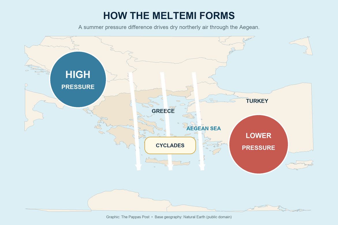
During summer, relatively high atmospheric pressure tends to establish itself over the Balkans and parts of southeastern Europe, while lower pressure develops farther east and southeast, particularly over Turkey and the eastern Mediterranean.
The pressure difference helps drive persistent northerly air through the Aegean.
The result is the wind Greeks call the Meltemi.
A detailed study published in the Journal of the Atmospheric Sciences found that the larger system is connected to atmospheric circulation extending far beyond Greece, including the Asian summer monsoon and weather patterns moving across the North Atlantic. Daytime heating over Anatolia can deepen the low-pressure area to the east, strengthening the pressure gradient and therefore the winds over the central and southern Aegean.
In other words, the Meltemi may feel intensely local when it is rattling the shutters of a house on Paros, but it belongs to a much larger atmospheric machine.
When does it blow?
The Meltemi can appear from late spring into early autumn, but its principal season runs through the heart of the Greek summer.
The National Observatory of Athens notes that the Etesians are characteristic of the warm season, with their greatest frequency and intensity during summer. Meteorological research places their strongest climatological period broadly from July into August, although strong episodes can continue into September.
So although August vacations may be winding down by the end of the month, the Meltemi does not necessarily follow the tourist calendar.
It also has a daily rhythm.
The wind frequently strengthens during the late morning and afternoon and eases somewhat after sunset. Research has found that this daytime increase can be particularly noticeable around the Cyclades.
But there is no rule saying the Meltemi must stop at night. During a sustained outbreak, strong winds can continue for days.
Why do the Cyclades get so much of it?
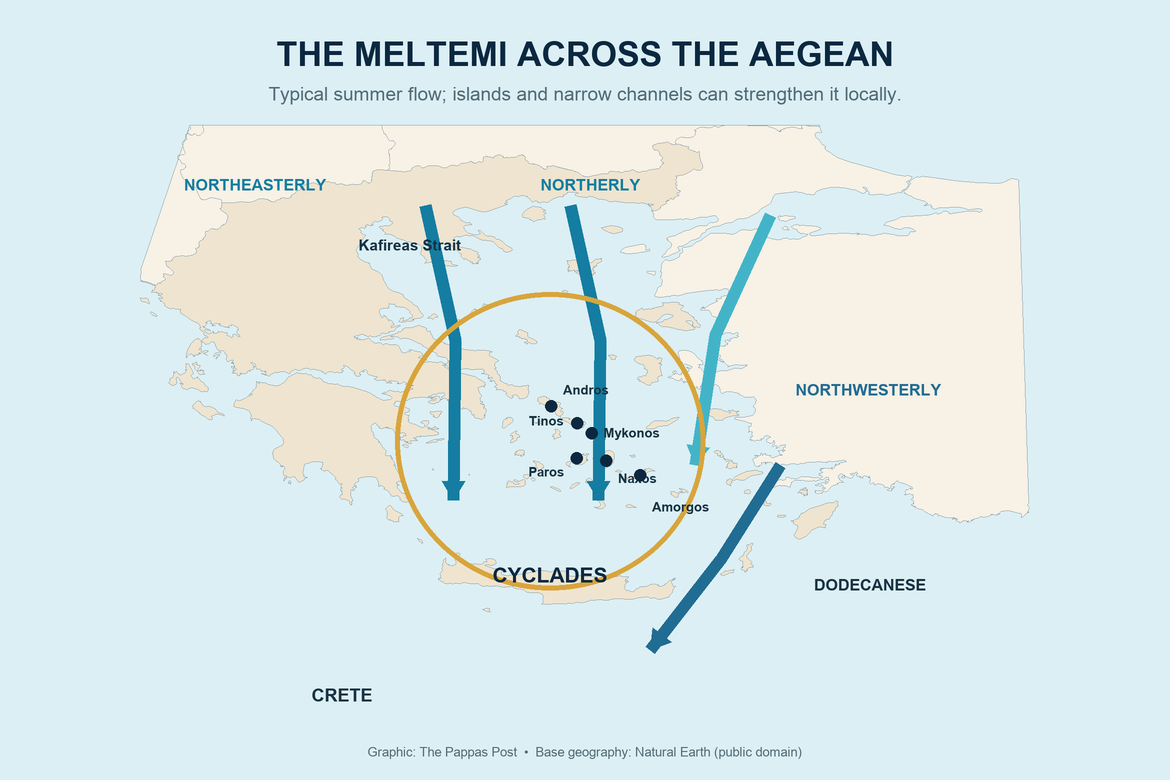
Geography puts the Cyclades almost directly in the path of the summer northerly flow.
Across the northern Aegean the Etesians tend to arrive with a more northeasterly component. Through the central Aegean and Cyclades they become predominantly northerly, before taking on a more northwesterly component farther south and southeast.
But the islands themselves make things more interesting.
The Aegean is filled with mountains, ridges, capes, valleys and narrow channels between islands. Wind squeezed through some of those gaps can accelerate dramatically—an atmospheric funnel effect.
Research into the Etesians has shown that the complex topography of the Aegean can strengthen winds between islands and create substantial differences over surprisingly short distances.
That helps explain a familiar Cycladic phenomenon: one side of an island may have relatively manageable conditions while another is being hammered by wind.
The effect is not merely anecdotal. The National Observatory’s August 2026 observations offered a particularly dramatic example: gusts at Porto on Tinos reached 104 km/h on August 15.
How strong can the Meltemi become?
A normal Meltemi does not mean a gale.
Etesian winds frequently reach around 6 to 7 Beaufort, while stronger episodes over the Aegean can reach 8 Beaufort or more.
For anyone unfamiliar with the maritime scale, 7 Beaufort is classified as a near gale, while 8 Beaufort is a gale. At that point the sea is no longer simply “windy.” Waves build, foam is blown into streaks and spray begins to travel through the air. The UK Met Office’s Beaufort scale provides a useful visual description of what those numbers mean at sea.
Forecast numbers also deserve some respect. The official Hellenic National Meteorological Service marine forecast warns mariners that gusts can be considerably stronger than the sustained winds given in a forecast and that individual waves can substantially exceed the reported significant wave height.
That distinction matters on the Aegean.
What does the Meltemi mean for ferries?
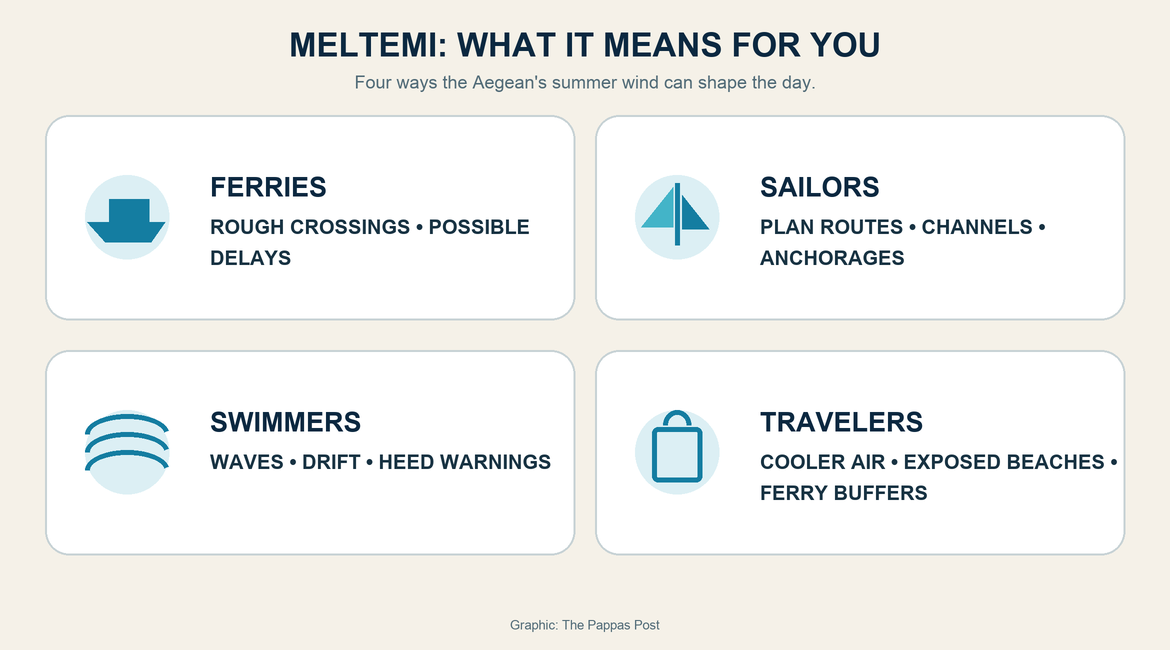
Usually, nothing more dramatic than a rougher crossing.
Modern Greek ferries are designed to operate in demanding seas, and strong wind does not automatically mean that every ferry stops sailing.
But sufficiently severe conditions can lead port authorities to restrict departures, alter routes or prevent particular vessels from sailing.
Wind can also create another problem travelers sometimes overlook: a ship may be capable of crossing the Aegean while conditions at a particular exposed harbor make arrival or departure more difficult.
For travelers, the practical lesson is simple.
A weather app showing sunshine does not tell you whether the sea will cooperate.
Before an important ferry journey during a strong Meltemi period, check the official EMY marine forecast and confirm the sailing with the ferry company or relevant port authority, particularly on the morning of departure.
Travelers with international flights or other fixed connections should also think carefully before constructing an itinerary that depends on a perfectly timed final ferry during a period of very strong winds.
Sailors know the Meltemi differently
To sailors, the Meltemi can be both an extraordinary gift and a serious challenge.
Steady summer wind is exactly what sailing boats need, and the Aegean’s prevailing northerlies have influenced navigation in the region for centuries. For experienced sailors, the Meltemi can produce spectacular conditions.
But the same wind can make an ambitious itinerary difficult very quickly.
Sailing south with a northerly behind you is very different from trying to return north into strong wind and a developed sea.
Around islands, funneling effects can also produce sudden acceleration and gusts considerably stronger than conditions a short distance away.
For recreational sailors, forecasts designed specifically for marine use—not general phone weather apps—should be the starting point. Local harbor authorities and experienced skippers also understand something a regional forecast cannot always convey: how a particular cape, channel or anchorage behaves when the Meltemi is blowing.
And swimmers should pay attention, too
One of the deceptive things about the Meltemi is that it usually arrives with quintessentially beautiful Greek weather.
There may be intense sunshine and excellent visibility.
Nothing about the sky necessarily says “danger.”
The sea may say otherwise.
Strong winds can create surf, difficult swimming conditions and rapid drift, while inflatable mattresses, paddleboards and other lightweight equipment can be carried away from shore surprisingly quickly.
The safest rule is an unglamorous one: respect lifeguard warnings, beach flags and local instructions.
On a strong-wind day, choosing a protected beach rather than an exposed one can completely change the experience.
The wind that makes the Aegean the Aegean
It is easy for visitors to think of the Meltemi as something that interferes with a Greek vacation.
Sometimes it does.
It can rearrange ferry schedules, send beach umbrellas tumbling, ruin the fantasy of a glass-flat sea and make a northbound sail considerably more adventurous than intended.
But removing the Meltemi from the Aegean would also remove something fundamental from the Greek summer.
It moderates heat. It contributes to the extraordinary clarity of many summer days. It created useful conditions for generations of sailors and today helps make parts of the Cyclades internationally known for windsurfing and other wind sports.
It bends trees, whips flags above island churches and sends waves breaking against rocky Cycladic shores.
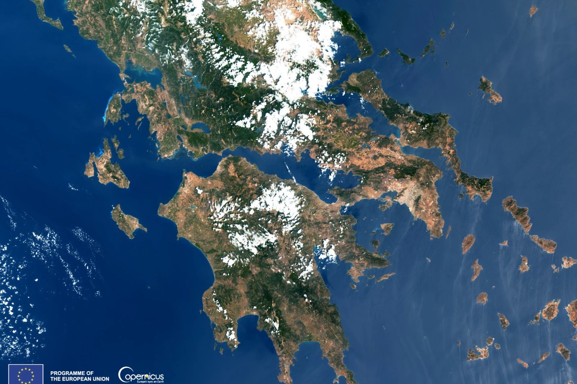
The effect can even be seen from space. In 2024, a Copernicus Sentinel-3 satellite image captured streaks and vortices produced by the Etesian winds around the Cyclades while waters farther west in the Ionian appeared comparatively calm.
That image captures something generations of Greeks have understood without satellites.
The Meltemi is not simply weather passing through the islands.
It is part of the rhythm of summer itself.