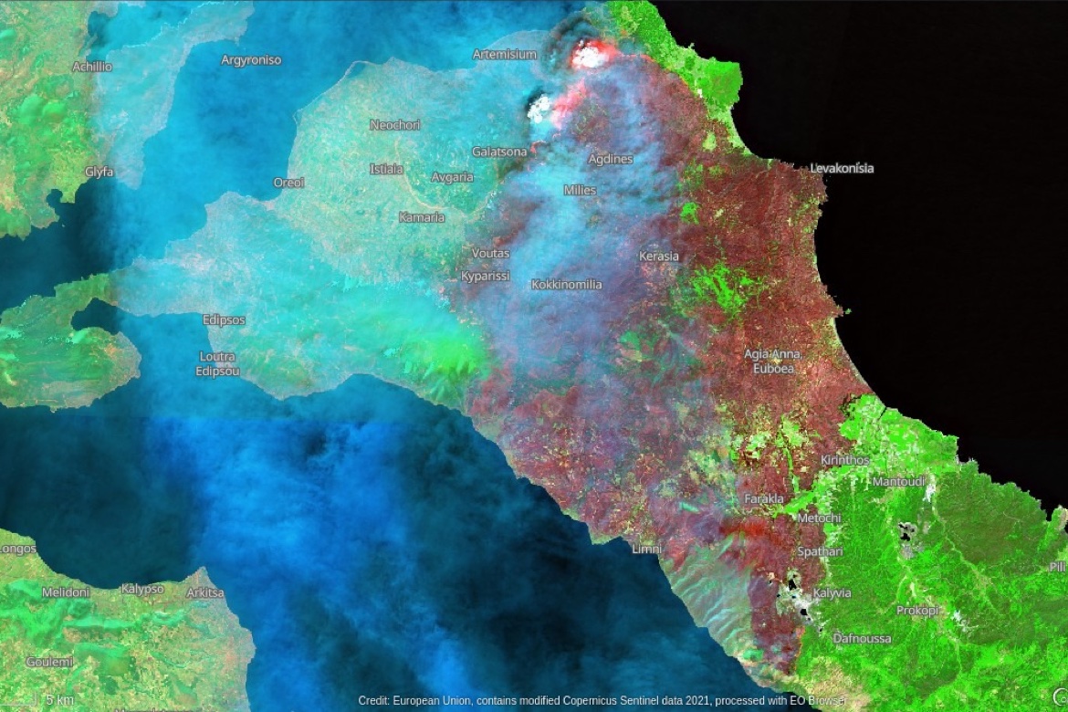
As firefighters continue to battle blazes throughout the country and dozens of nations rush to support Greek efforts, satellite images reveal the extent of the destruction on the island of Evia, where thousands of people were evacuated in harrowing scenes captured on video.
Burning since August 3, the blaze has destroyed most of the north of Evia’s rugged mountainous forests.
The image, acquired by one of the Copernicus Sentinel-2 satellites on August 8, shows the ongoing wildfire on the island.
Greece is experiencing a devastating fire season following the most intense heatwave in the last 30 years, with temperatures reaching 113 F.
According to data from the Copernicus Atmosphere Monitoring Service (CAMS), carbon emissions generated by fires in Greece are the highest in 13 years.